|
Create detailed 3D models from images and laser scans with ease. Our photogrammetry solution makes it simple for anyone to turn their surroundings into astounding digital replicas. - All RealityScan features
RealityScan Mobile Bring objects to life in 3D using your phone. Turn your phone into a powerful 3D scanning tool and bring the real world into digital space. With RealityScan Mobile, you can capture, process, and share high-fidelity scans effortlessly, all from your mobile device.
Ready for any challenge. Capture your surroundings. Scan objects. Preserve artifacts. Recreate reality in stunning detail and transform real-world objects into immersive digital environments. No matter the industry, scale, or purpose, RealityScan provides the tools to turn the physical world into high-quality digital assets with speed and precision.
Capture the world around you. Turn reality into stunning digital replicas, reconstruct entire environments, and create assets from real-world objects. With RealityScan, you have the freedom to effortlessly transform the physical world into high-quality digital models. We continue to push the boundaries of photogrammetry, ensuring that you are the one who defines the limits of what’s possible.
Features From small objects to expansive environments, RealityScan (formerly RealityCapture) empowers professionals with an end-to-end photogrammetry pipeline that delivers high-fidelity photorealistic 3D models and precise point clouds at any scale.
Precision scaling and georeferencing Automatically scale your model using coded markers and defined constraints, or import ground control-point measurements, flight logs, or RTK/PPK accuracies to align it with world coordinates and ensure survey-grade accuracy. Use XMP metadata to lock and reuse camera priors (precomputed camera positions and orientations), which is useful for reconstruction of repetitive objects and human scanning with fixed camera rigs. 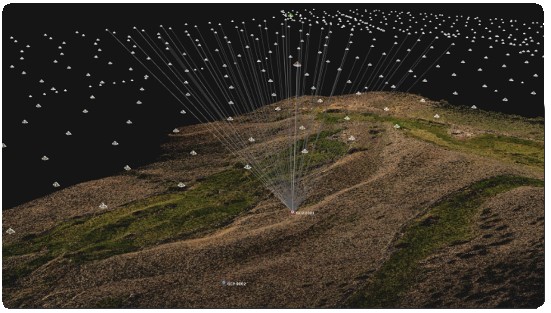
Scalable UV unwrap solution Pick between default geometric or mosaic unwrapping methods to optimize texel density and texture quality. Use a fixed texel size style to achieve maximal texture resolutions that match your imported imagery, or adjust the number of textures and their resolutions to find a balance between UV chart size and texture utilization. 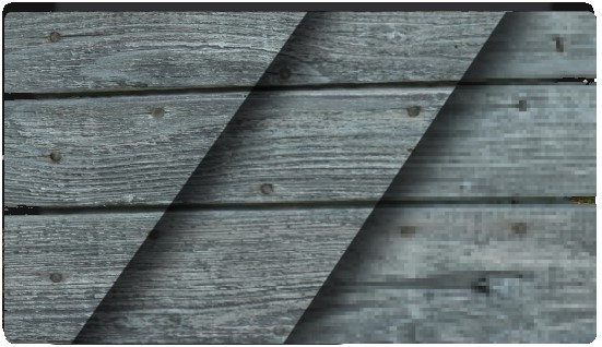


|